

Why is an imaging satellite constellation acting like a mobile-satellite communications system?
China’s first self-developed commercial remote sensing satellite system known as JILIN is sending strange wideband data pips in a quiet piece of spectrum on L-band. The JILIN system is operated by Chang Guang Satellite Technology Company in Beijing. No public references have been found by the author about what these emissions from the satellites purpose is.
Mysterious ‘Pips’ from the Ether…
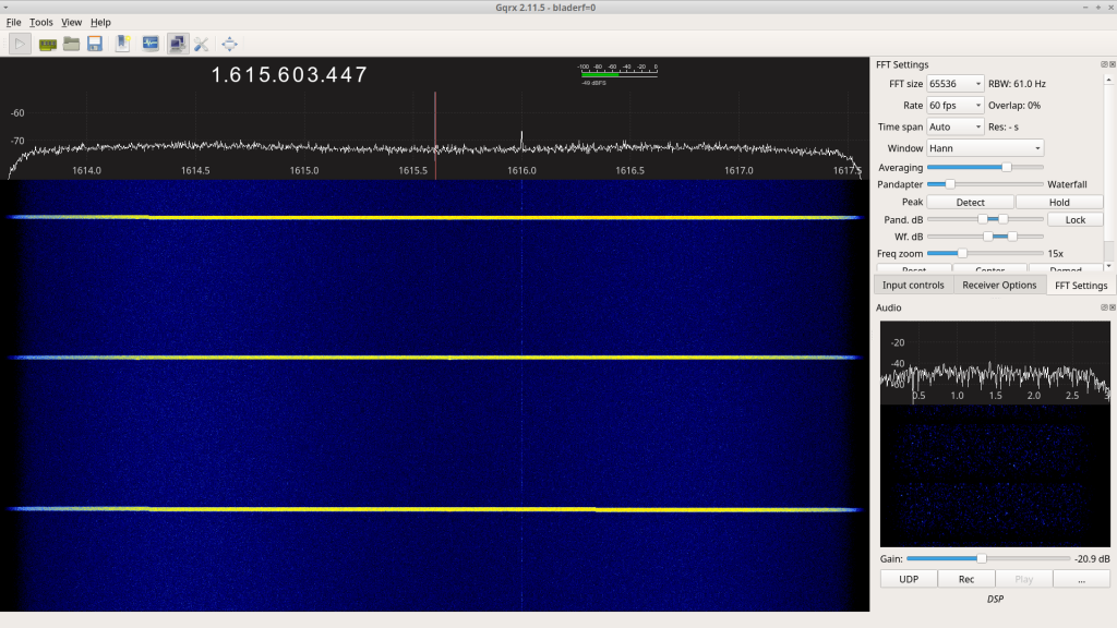
While investigating the portion of L-band between 1613.8-1626.5MHz, I stumbled across some brief ‘pip’ emissions that clearly had LEO Doppler effecting the signal.
A bit of analysis later the ID came back to one of the many JILIN satellites in a constellation in sun synchronous orbit at about 535KM altitude with a plane spanning approximately 260-295 degrees of RAAN.

JILIN-01 GAOFEN 3D [52390, 2022-046C] Doppler analysis.
A prolonged scan of over a day was then completed to get a sense of the extent of the spacecraft involved displaying this behaviour. As of July 26th, 2022, a total of 29 spacecraft from the JILIN constellation have been observed emitting these signals. A list of observed ‘pipping’ JILIN spacecraft below:
| INDEX | ID | COSPAR | ST NAME | FREQ |
| 1 | 46454 | 2000-065A | JILIN-01 GAOFEN 3B | 1615.659104 |
| 2 | 46457 | 2000-065D | JILIN-01 GAOFEN 3E | 1615.661645 |
| 3 | 46458 | 2000-065E | JILIN-01 GAOFEN 3F | 1615.664082 |
| 4 | 46459 | 2000-065F | JILIN-01 GAOFEN 3G | 1615.665521 |
| 5 | 46460 | 2000-065G | JILIN-01 GAOFEN 3H | 1615.665531 |
| 6 | 46462 | 2000-065J | JILIN-01 GAOFEN 3J | 1615.655837 |
| 7 | 49004 | 2021-061B | OBJECT B | 1615.660286 |
| 8 | 49006 | 2021-061D | OBJECT D | 1615.665804 |
| 9 | 49007 | 2021-061E | OBJECT E | 1615.660667 |
| 10 | 51831 | 2022-019H | OBJECT H | 1615.656718 |
| 11 | 51834 | 2022-019L | OBJECT L | 1615.658552 |
| 12 | 51835 | 2022-019M | OBJECT M | 1615.659091 |
| 13 | 51838 | 2022-019Q | OBJECT Q | 1615.663918 |
| 14 | 51839 | 2022-019R | OBJECT R | 1615.66365 |
| 15 | 51840 | 2022-019S | OBJECT S | 1615.665496 |
| 16 | 51841 | 2022-019T | OBJECT T | 1615.666917 |
| 17 | 51846 | 2022-019Y | OBJECT Y | 1615.661015 |
| 18 | 52388 | 2022-046A | JILIN-01 GAOFEN 4A | 1615.676831 |
| 19 | 52389 | 2022-046B | JILIN-01 GAOFEN 3D 4 | 1615.666593 |
| 20 | 52390 | 2022-046C | JILIN-01 GAOFEN 3D 5 | 1615.654755 |
| 21 | 52391 | 2022-046D | JILIN-01 GAOFEN 3D 6 | 1615.657329 |
| 22 | 52392 | 2022-046E | JILIN-01 GAOFEN 3D 7 | 1615.660335 |
| 23 | 52444 | 2022-048B | JILIN-01 GAOFEN 3D 27 | 1615.662377 |
| 24 | 52445 | 2022-048C | JILIN-01 GAOFEN 3D 28 | 1615.663839 |
| 25 | 52446 | 2022-048D | JILIN-01 GAOFEN 3D 29 | 1615.667828 |
| 26 | 52447 | 2022-048E | JILIN-01 GAOFEN 3D 30 | 1615.653586 |
| 27 | 52448 | 2022-048F | JILIN-01 GAOFEN 3D 31 | 1615.669229 |
| 28 | 52449 | 2022-048G | JILIN-01 GAOFEN 3D 32 | 1615.669492 |
| 29 | 52450 | 2022-048H | JILIN-01 GAOFEN 3D 33 | 1615.671647 |
Diurnal Behaviour of the ‘Pipping’…
The piping appears to be most pronounced during the daytime at my observing site. They are active at night but much less so than during daylight.


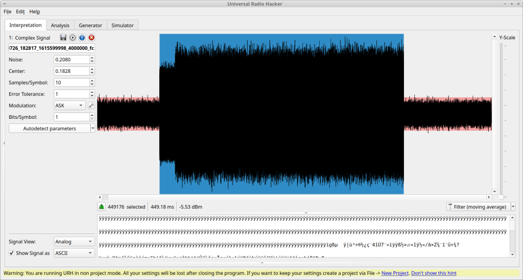
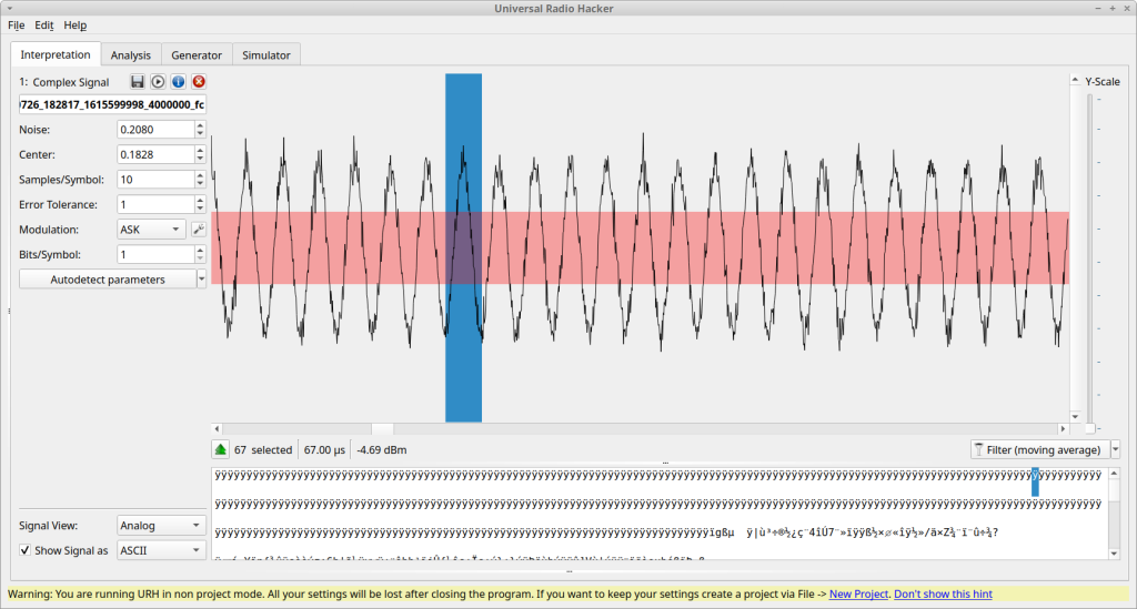
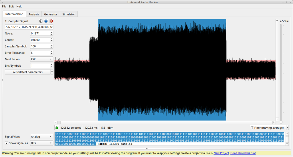
So what’s in a ‘Pip’?
The ‘pips’ appear to be about +3MHz in bandwidth and ~0.5 seconds in duration. The transmission interval is around 4-10 seconds when they are active but many spacecraft are not active on each pass and when they are they may not ‘pip’ for the entire pass and may even change their ‘pipping’ rate.
As noted the ‘pips’ are ~0.5 seconds in length. An analysis of the temporal characteristics reveals two distinct components of the signal. A brief dissection of the signal characteristics follows.


So why ‘Pip’?
Why would a constellation of Earth imaging satellites be sending brief wideband data bursts on L-band? To perhaps gain some insight, I reviewed how the People’s Republic of China allocates this part of the spectrum.
1 613.8-1 626.5 (MHz)
MOBILE-SATELLITE(Earth-to-space)  S5.SSS
AERONAUTICAL RADIONAVIGATION
RADIODETERMINATION-SATELLITE (Earth-to-space)  S5.369
Mobile-satellite(space-to-Earth)
S5.341  S5.364  S5.365
S5.366  S5.367  S5.368
S5.372   CHN18
Out of all the services allowed to operate in this band on, “Mobile-Satellite(space-to-Earth) matches what we are observing. After much research we can find no reference on ITU filings or in news reports about why there would be data ‘pips’ coming from the JILIN satellites. The only other service that remotely matches the Mobile-satellite service from China that is presently active is the GEO based TIANTONG system which uses different frequencies etc.
A reference was found to HONGYAN which has only one prototype in orbit. The orbit of which closely resembles that the of US GLOBALSTAR system which also uses the band in question. In fact, the Globalstar system uses 1616.26MHz to allow for satellites in LEO to uplink to the Globalstar satellites to allow for 1-way and 2-way telemetry and control. They also use this band to allow Earth based assets to report data via the Globalstar constellation as well. With only one old spacecraft HONGYAN-1 in orbit it’s unlikely the Chinese owners of the JILIN’s are doing something similar to Globalstar so what ever the purpose it could be something related to JILIN’s operations.
The diurnal behaviour of the system could mean that it is either driven by human activity (most people like to sleep at night) or it could be part of the primary known purpose of the JILIN constellation which is Earth imagery at optical wavelengths, perhaps allowing a client to place a transponder on an asset and have the spacecraft interrogate it and image its location as it moves around…? It is possible it is used for other purposes but that would be outside the official allocation for the People’s Republic of China. If you review Chang Guang Satellite Technology Company‘s website you can see from their sample images individual cars can be seen so it is possible this could be some sort of asset tracking system.

Samples of the signal have been shared with a few different colleagues and we’ll report back if anything interesting is determined from those analysis efforts to answer this Chinese Riddle in the Sky!
